The Final Mile
¤
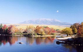
Two battered but hopeful pilgrims enter the promised land
Monson, ME to Mount Katahdin
This is it - our final AT hike, and even in the preparation stage there's a bittersweet feel about
it. At every turn - packing the packs, loading the car, driving the familiar route - we're reminded
that this is the last time we'll do these chores. In fact, as we're driving up Coleen is driven to
tears as I read the journal of one of our hiking friends who just summited - something I expect to
see more of this week. We've learned so much and had so much fun that we'll hate to leave the trail
behind; but still we're excited about seeing the great Katahdin face-to-face. We're also looking
forward to the "100-mile wilderness", a rugged but beautiful stretch of trail, and there's that
feeling of walking on hallowed ground even as we read the familiar names - Abol Bridge, Thoreau
Spring, Daicey Pond. This is the day we've dreamed of for four years now. Valhalla awaits!! |
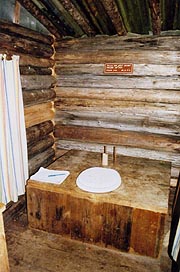
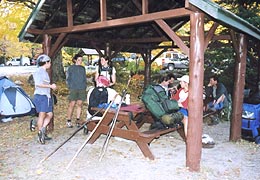
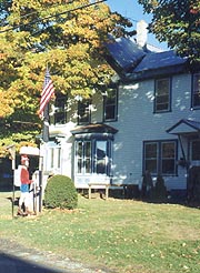 |
| The legendary Shaw's Boarding House |
|
10/5 Monson � Vaughn Stream tentsite (13.6 miles)
"Go confidently in the direction of your dreams.
Live the life you'd imagined."
Henry David Thoreau
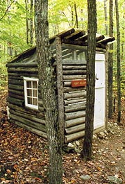
Dawn finds a gorgeous autumnal day outside, and over at Shaw's a substantial crowd of 16 is
assembled for breakfast. Being the last of the heap, we end up at the "kiddie table", starting on
coffee as Keith's still taking orders from the main table, where we see Rifraff and a couple other
familiar faces. With the Shaws' typical efficiency we're soon stuffed well beyond the dictates of
good sense, and raring to tackle the wilderness. Many of the hikers are slacking parts of the
wilderness, several taking zero days here as well - we seem to be the only ones anxious in getting
out (of course we weren't out hiking in yesterday's torrential rain), with Keith dropping us at the
trailhead at 8:20. We're almost giddy about the prospect of our final hike, with one final kiss
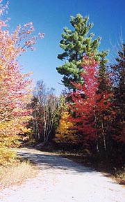
here before launching into the wilderness. The woods are full of autumnal color and fresh post-rain
aromas as we head down to Goodell Brook, shown as our first ford but actually bridged.
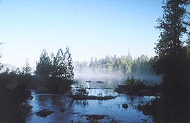
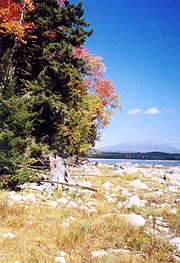
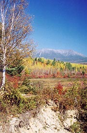
|
| The fog lifts as we enter the "100-mile
Wilderness"
|
|
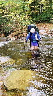
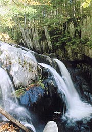
The trail is easy and beautiful as we begin, although my first omen comes at Leeman Brook, where a
pile of logs offers a crossing. I start across a bigger one, but Coleen suggests a smaller pair,
which breaks immediately under my weight, plunging my right leg knee-deep into the water. There's a
Lean-To just atop the hill after however, where I stop to wring out my sock, another section hiker
pulling up moments later. Someone's left a headlamp hanging here in the shelter, and he asks if
it's ours; on getting a negative reply he promptly puts it in his pocket, in spite of Coleen's
suggestion that it might belong to someone in need. My woes are compounded on finding that one of
the seams on my left boot is coming apart quickly, but Coleen resolves to sew it later (I'm
skeptical). We resume our hike, soon coming on the beautiful but roaring Little Wilson Falls,
finding just downstream a small campsite called Lucies Spot. Someone has assembled slate slabs into
chairs and a love seat - very cute (and even with a register). We take a quick break here before
heading on, though we immediately find our first real ford is this stream, with the current surging
mightily at the chosen spot. We look up and downstream, but this is the best spot, so we take off
our boots, and I put in my flip-flops to give it a go.
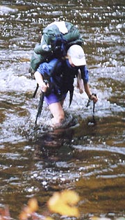
The current's powerful indeed, having to brace against two poles to stay upright against its force.
Midway across I hit the mainstream, stabbing downstream with Coleen's pole to hold me up; but it
collapses, sending me under. I'm up momentarily, but with the collapsed pole on the downstream side
I'm knocked down again, having to turn around to plant a pole and get my footing back; by now with
my gear and clothes soaked. Coleen's stuck in the middle with similar problems, but I'm now on good
footing, and able to extend a pole for her to grab, pulling her over to the calmer waters where I'm
standing. We get on the shore and as I'm drying out she heads down to look for the gear I'd lost -
my hiking pole, one flip-flop, and my cap; but it's all long gone, well past the waterfalls below
us.
I'm freezing as I try to get some socks and boots back on, but luckily the pack protected most of
its contents, and most of my fanny pack gear was individually sealed. The radio needs a little
drying (tonight I'll find it totally inop), but other than this and the lost gear, we've gotten off
lucky (though I have several big bleeding abrasions on my right foot and a jammed right thumb). We
head north, immediately running into Turtle, hiking south without her sick hiking partner (Magic Rat
- recovering at Shaw's). She's heard plenty of horror stories about this ford, and I suggest we'll
wait for her to cross in case she has trouble. She dives right in, boots and all; and predictably
gets knocked down in the middle. She gets right up though, getting knocked down a second and third
time before she's finally across, but heading up the bank with a wave and making tracks for town.
We head on, crossing the Canadian Pacific RR (last one on the AT), and thence into the Wilson Valley
Lean-to for a pm break. Here we meet Pirahna and Indiana Slim - they both got knocked down in the
ford as well, and I ask them if they were missing any gear, finding the missing headlamp was Slim's.
I tell him that it's heading his way, but it's tough to say if the kid will catch up, or even
continue through the ugly ford.
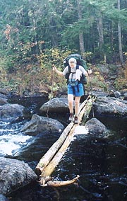
I find a stick to serve as a pole, and we forge on, soon coming to the Thompson Brook crossing �
it�s not marked as a ford, but in today�s water it turns out so. It�s an easy one though (in our
boots), providing an opportunity to take some pix of Coleen in the knee-deep ford. After this we
come to the ford at Big Wilson Stream - advertised as tougher than Little Wilson, but we'd heard
from everyone that the opposite was true (the map even offers a 3-mile detour). It�s a wide ford,
but the depth and current are such that it�s far easier than Little Wilson, having Coleen wait so I
can take several pix as she crosses. We're buoyed a bit by these successful fords, although we've a
couple more to do today, with darkness falling quickly. Our planned stop for tonight is a campsite
we've heard about at Vaughn Stream, but we're unsure which bank of this forded stream it's on. Just
before we arrive, there's an easy but dark ford of Wilber Brook, but Vaughn Stream proves otherwise
- it's at the top of a 20' tall waterfall, and a spill here would prove disasterous. Not only that,
it�s pitch-dark and even our headlamps won�t reveal the stream's depth � all we know is that it�s
roaring full-force, worsened by the din of the waterfall. A note here suggests there�s a downed
tree .3 downstream, but it�d be an ugly bushwack indeed � we try about .1 and quickly give up.
Finally we rule out the ford as too unsafe tonight, deciding to take a small cubbyhole off the side
of the trail for our tent. By now, we�ll just have our sandwiches for dinner and bed down anyway;
so we don�t need much of a site. We set up the tent under starry skies and a nearly full moon,
setting out what gear we can to dry, and finally finding a good bear-bag tree. The stove just fits
next to the tent, and we have hot drinks and turn in at 9:45, feeling totally exhausted by our
surprisingly tough day.
10/6 Vaughn Stream � Chairback Gap Lean-to (12.4 miles)
"Anyone can hold the helm when the sea is calm."
Publius Syrus
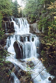
|
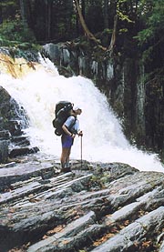
|
| Little Wilson Stream Falls - little do we imagine how
tough this will be to ford.
|
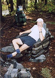
|
| Pondering the inevitable at "Lucie's Spot"
|
|
| Finally - an easy ford at Thompson Creek
|
|
We�re up at 6:22 with a slow start to our morning, interrupted by a deer dropping by to see what
we�re up to and the finding that our boots and socks outside are frozen solid. Since we'll begin by
fording the stream, the socks needn�t be warm anyway, so we put them inside our jackets to thaw (we
were toasty overnight) and go about breakfast and coffee. I�ve slept with my radio, drying it
enough for marginal reception, though it�s still pretty weak. Afterwards, we�re "ready" to take on
the big ford, which isn�t so bad in daylight with the water levels having receded throughout the
night. Our next ford will prove otherwise however.
We hike down to Long Pond Stream, split by an island mid-stream. We ford to the island easily
enough, but the torrent from here is totally impassable. A testament to its hopelessness is a
one-inch rope once tied across to aid, but now has been broken � not cut, obviously by debris
ramming into it. I search the length of the island, even fording out into the swift current at one
point, but it�s far too strong and deep, and I quickly retreat. A foray downstream and upstream
find little of help, and all the map shows is that the road leads to a bridge 1.5 miles downstream
(though the return to the trail would involve an equal bushwack, which would take hours. We follow
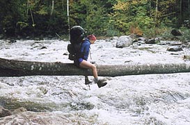
the road downstream, soon finding a downed log spanning the creek � Coleen wants to try to walk it,
but a spill would be disasterous, the log being about 4� in the air, with a wild river underneath.
I convince her to straddle the log and shinny across, though it's impossible for me, my pack frame
extending well below my butt. I find a calmer stretch just downstream from here, where I�m able to
ford, and by the time I get back to her, she�s just cleaning up herself, having taken a spill on her
dismount. We�re very glad to have this over with, and from here it�s a short climb up to the
lean-to for a quick break.
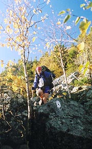
Next is for the climb over Barren Mt, a steep climb to a windy, cold summit,with a few peeks of
sunlight, though the surrounding mountains are already obscured in cloud. We find a leeward spot
for a break atop, where we�re surprised to be overtaken by the first hikers we�ve seen out here �
Indigo and Cruisin. They�re nice folks, a little older like ourselves, and we follow them a ways
afterwards, though once they're out of the rocks, they speed away. On the rough trail down, I take
a couple small falls � no major hurts, but enough to convince me to swap my makeshift pole with
Coleen to use one of her good ones. After Barren Mt follow four more peaks in the range, taking our
next short break on the steep Fourth Mountain. The treadway is rough as promised, full of rocks,
roots, and mud; our progress so slow that Coleen supposes we�re climbing Columbus Mt when we�re
still on 3rd Mt. By the time we finally do summit Columbus, it�s 6:20, with darkness falling
quickly, using our headlamps for our final rocky descent. (We'd hoped to push on to the shore at
East Chairback Pond, but the rough treadway and difficult fords slowed us until we don't even make
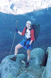
Chairback Gap Lean-to by dark.)
| We're feeling confident after a couple easier fords -
this is "Big" Wilson Stream |
|
| And then comes the impossible ford at Long Pond Stream -
thank goodness we found this log downstream. | |
Pulling up to the Lean-to, we�re surprised to find one couple already turned in for the night (Tank
& Willow), with a tarp secured over the front of their half the shelter presumably to keep out the
wind. Indigo and Cruisin are camped out to our left and just cooking dinner, so we move some gear
around to make room, having a quiet dinner and hot drinks, though we�re entertained a bit by the
aggressive and acrobatic shelter mice. Even as we cook, they�re scurrying around the stove
brazenly, one of them already climbing around my pack even as I stand next to it. We�ll see one of
them do a tightrope act across our clothesline, and in the morning we�ll find they�ve figure out how
to jump from pack to food bag to get food (Willow finds one�s gotten into their meager food supply).
Coleen�s surprisingly calm about it though, and they quiet down long enough for us to get to bed at
9:00.
|
10/7 Chairback Gap� Hay Mt tentsite (14.6 miles)
"Two roads diverged in a vernal wood, and I -
I took the one less traveled by,
And that has made all the difference."
Robert Frost
|
|
We're up with first light, finding our gear survived the mouse onslaught well (though we'll later
find a small hole in the jerky sack, which Coleen forgot to put in the food bag). Indigo and
Cruisin beat us out; although Tank and Willow lag a bit, worried about their meager food supply,
which didn't anticipate all the time lost in yesterday's ford (they ended up going down to the
bridge with the 1.5 mile bushwack). It's a beautifully clear and cloudless morning, and as we top
the exposed ledges of Chairback Mt, we can see Indigo and Cuisin way below us on the descent,
yelling across the chasm and waving poles at them. It's reminiscent of the Saddleback's as we
descend the rocky cliffs, but eventually it winds back into the woods for the endless descent to the
Pleasant River.
|
|
The Pleasant River ford is advertised as difficult in high water, but we've heard otherwise, and
when we arrive, we see Last Minute, Blip, and Viking on the other bank, yelling that it's only knee
deep. We both decide to do it barefoot, which works out well, and we take a relaxed break on the
other bank, our "difficult" fords now behind us. From here we enter the Hermitage, a beautiful
stand of ancient pines that was once the source of ship masts (so highly prized that stealing of
same was punishable by hanging). The trail climbs a bit before passing the turnoff for the Gulf
Hagas Loop - a series of gorges and waterfalls described as "the Grand Canyon of the east". Several
of the others have left their packs here to take a peek; and we initially continue past, but on
reflection decide to have a quick look ourselves, dropping our packs off the trail and crossing the
creek on a fallen log on the trail to Screw Auger Falls, a nearby sample of the attractions. We
take a few pix before returning to the trail, following the beautiful Gulf Hagas Brook up through
golden birch glades to the Carl Newhall Lean-to for our pm break. There's a rock hop on the Lean-to
path, this one with a rope to aid (how helpful this would have been at Little Wilson), but even so,
Coleen gets her legs crossed up, taking a spill, albeit unscathed.
From here continues our last big climb until Katahdin, starting with a hop over Gulf Hagas Mt to the
Sidney Tappan Campsite - the obvious choice for our night's stay, but not quite far enough for our
plans. We really want to stop at the White House Landing fishing camp (the only outpost of
civilization in the wilderness) the day after tomorrow, but with the rough trail, we're doubtful we
could make it if we stopped here. Though there are no campsites shown after Sidney Tappan, but
we're hoping to find somewhere to "cowboy-camp", and Coleen wants the WHL stop bad enough that she's
on board. As we're crossing Gulf Hagas Mt, we find Last Minute and Blip stopped, writing a note to
Tank and Willow; and Last Minute points to our left and says, "How about that view?". Surprise of
surprises, there's Mt Katahdin in the distance, with quite a bit of snow on the western face! It's
exhilerating, and Coleen's even more excited, having never before seen the object of our 4-year
quest (I see it often flying back from Europe, pointing it out to my passengers whenever I can). We
continue with renewed energy, soon reaching Sidney Tappan, where we'll tank up on spring water
before setting off in search of a campsite. As we do, Last Minute and Blip pull up to do the same;
and just as we're all about to leave, Tank and Willow pull up as well. They're ready to call it a
day; and they go to work talking the others into same, although we're bent on the miles, heading out
for the steep climb up West Peak.
Our doubts start soon after - the climb's a tough one, the terrain totally inhospitable to "cowboy
camping" - the dense scrub forms a solid wall right to the trail's edge. I've also found earlier
that my right boot sole has separated from the upper on the inside, leaving some worry as to whether
it'll survive to Katahdin without major repair. The sighting of Katahdin uplifts us however, and we
push on over West Peak, down into the col, and thence up the more gentle climb over Hay Mt. Atop
there's a small square hole carved into the scrub just big enough for a tent, but we're hoping to
get another mile or so, camping at a trail intersection in the col following. Sure enough, on
arriving at the White Brook Trail, there's a perfect-sized campsite off to the left, with a good
sitting log and a couple stumps that we'll count as an answer to prayer. We've just time enough to
set up the tent and start dinner before darkness sets in - another beautiful night, with an orange
sunset in the west as the full moon rises. We have a couple rounds of hot drinks and settle into
the tent to work on my left boot, but just as we do a shower comes out of nowhere. It's short-lived
however, and as Coleen tries to stitch the boot seam she manages only a couple weak stitches at best
(surprisingly, they'll hold all the way to Katahdin). Lights out at 9:30.
|
|
| Even the rocky descents aren't bad in sunshine
|
|
| The beautiful Screw Auger Falls on the Gulf Hagas
loop
|
|
10/8 Hay Mt � Jo-Mary tentsite (16.9 miles)
"Does't thou love life? Then do not squander time,
for that is the stuff life is made of."
Benjamin Franklin
It's a windy night, the alarm sounding at 5:40 (we're hoping for good mileage today), finding a
clear morning outside as the sky begins to lighten. Unfortunately, I'm struck with gastrointestinal
distress immediately, having to bushwack into the impenetrable scrub to find a log on which to do my
bidding. It's not pretty, but I get through the ordeal without lasting scars - back at the camp,
Coleen's got coffee ready, and I pop a couple Immodium, a little unsure if they'll work. We get
away soon after, sweating up the steep climb of White Cap Mt, where we stop a few minutes atop to
savor the view from a side trail. It's most hikers' first view of Katahdin, though in the morning
mist it's not even so good as yesterday's from Gulf Hagas. From here it's another rocky
Saddleback-like descent (entering the section our friends Honey and Bear maintain), our two big
climbs in the wilderness now behind us. The profile shows fairly level hiking from here to Katahdin,
although we'll soon find that the rough treadway negates this advantage.
We get a quick chat with Viking packing up at Logan Brook Lean-to, running into him again at the
East Branch Lean-to. From here there's a short ford at the Pleasant River East Branch (almost a
rock-hop), and we stop for a break on the rocks at the other bank, a chipmunk appearing immediately
on our arrival to mooch some food, as Viking passes us again. There's a quick pop-up to Mt View
Pond (a beautiful pond, which like most here has a number of canoes sitting aside it), with another
popover of Little Boardman, and a gentle descent to Kokadjo B Road, with lunch on a convenient rock.
Just before we arrive, we'll run into Lion King hiking south, just dropped at the road by Keith
Shaw. He carries a water bottled filled with a dark frothy brew, and is already a bit souced,
having left his pack and some beers for the guys at the road. He does give us a weather update,
with good prospects for a Sunday summit, degrading after. He continues the search southbound, hoping
to get everyone together for a party at the upcoming lean-to. We push on, stopping at the upcoming
Cooper Brook Falls Lean-to to filter water. Tins once full of trail magic have been left here, but
it�s long gone now, and though we�ve talked about stopping here for the night, the upcoming revelry
and long miles for tomorrow convince us to push onward.
The trail follows the rushing Cooper Brook on an easy profile, though the rugged surface still slows
us, and we�re glad for the extra miles tonight. As darkness falls we search for tentsites, but the
pickings are slimmer than imagined. There�s plenty of huge pine forests that normally encase good
camping, but here they�re filled with downed trees, and old mossy growth covering huge rocks with
rotting vegetation all about. Finally we find a flat place with a good surface and a few logs for
sitting and such; though as we�re setting up camp we�re surprised to hear a truck fly by not 100
yards away. We must be near Jo-Mary Road, settling in to the sound of a hoot owl as the moon rises.
I find enough rocks for a fire pit next to our sitting log, and we go about our usual evening
affairs, though we quickly get into a spat about our upcoming days. With today's forecast I really
want to summit on Sunday, before the weather moves in; but if we stay overnight at White House
Landing, this would require doing two 20-mile days afterwards, daunting at best. Coleen�s dead-set
against it (but still wants her night at the White House), so we�re in less than a convivial mood
when we retire at 9:00.
|
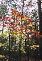
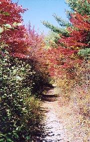
| The Maine foliage is approaching peak, and we're seeing
more of the reds and oranges as we continue north.
|
 |
|
10/9 Jo-Mary � Nahmakanta Lake tentsite (16 miles)
"Even a fool, when he keeps silent; is considered wise"
Proverbs 17:28 |
|
A truck roars by 5:00, but we sleep in another :40, finding the skies clouded over outside as we
continue down Cooper Brook, though Jo-Mary Road isn�t very quick in coming. When we finally pass
it, I conclude we were a mile prior, though it remains a mystery what road we abutted (nothing on
the map). There�s a thin patch of blue in the skies as the trail takes us down to the beautiful
Antlers Campsite, featuring the exotic Fort Relief privy. In the privy register (no kidding) we
find that Viking just passed through (no pun intended), we're soon passed by Rifraff, Monk, and
Scabs, the trio blazing by us like greased lightning. We�ve slowed quite a bit, and Coleen�s
hurting and feeling a bit dejected � luckily there�s a nice sand beach on the other side of the lake
for our break. By now we both see the futility of two 20-milers, and luckily she suggests that we
confine our White House visit to a mere lunch & shower stop.
I�d considered this, but didn't think she'd buy it, so I was overjoyed - now we could hike another 5
miles today, making the next two more manageable 17.5-milers. I�m glad she�s so willing, and now
the sun comes out, further enhancing our spirits. We pass the Potaywadjo Spring Lean-to, stopping
for just a moment to look at it�s 15� diameter �bubbling� spring, after which the trail soon passes
the shoreline of Pemadumcook Lake, where I stop for a pix of the expansive rocky beach. Catching up
with Coleen however, she�s standing by a side trail suggesting, �I thought you�d want to see this�,
finding around the corner a spectacular view of Katahdin. It's getting closer by the minute, and we
both resume with renewed vitality. We�re looking for the White House turnoff, and as we approach we
find business cards tacked on the trees with more specifics. We hit the turnoff at 12:47, turning
down the road and immediately running across Indigo, Cruisin, ChillyWilly, and Kilroy coming out,
insisting we have to drop in for burgers. They also confirm that the forecast we�d heard,
along with the closure of Katahdin the last two days, with 40 hikers waiting to summit. This
cements our plan, as we don�t want to get hung up by weather, and we forge on with renewed
enthusiasm, taking :30 to get to the air horn from where we can summon our ride.
A word about the WHL is in order: It�s the one remaining of a series of fishing camps built in 1911
- a tiny oasis of civilization amidst the �100-mile wilderness�. The side trail leads 1.2 miles off
the AT to the lake shore, where we're to sound the air horn ONCE, after which Bill (when he
gets round to it) cruises over in his boat for the pickup. On our arrival, the lake was exceedingly
low (a result of some adjustments by the proprietors of the dam), forcing Bill to move his dock 75
yards away from the air horn recently to allow clearance for his boat. It's a momentary wait for
the boat, and as we head across Bill announces that lunch was over at 1:00 (it�s now 1:30), and that
dinner won�t be served until 4:00 � not exactly what we�d hoped for, but we�ll wait, having come
this far. As we reach the lodge however, Bill runs inside, returning to advise that since no one�s
staying overnight, they�ll get us fed and out. We leave our packs and boots outside, heading in to
find all our fellow hikers just finishing dessert. We grab a table and order up the monster burgers
immediately, with the aroma of frying butter and Worcestershire Sauce filling the room. Bill runs
around muttering about everyone and everything, but his wife Linda is quite pleasant, and soon we�re
wolfing down the huge burgers we�ve craved. Everyone else is settling up, and we�re rushed to get
through (Bill�s muttering about their own lunch), so we hurry through, settling up ($21.75) with the
door locked quickly behind us as they close down the lodge.
Coleen wants a shower, for which a nice bath house is provided a few cabins down, and I busy myself
with filling water bottles and catching up on my journal, soaking in the sunshine on the picnic
table this beautiful autumnal day. Bill and Linda have long disappeared, but soon Bill comes back
for our ride across. The side trail goes much faster on the way back (we�re really energized by the
resolution of our plans, and of course, �town food�), finding Last Minute and Blip at the AT
junction, trying to decide whether to wait for dinner hour here. They�re joined as we chat by
Turtle and Magic Rat (staying for the night � Turtle saw a cute bear cub in a tree today, howling
for his mother), but we�re anxious to get some miles behind us. We shove off, with the typical rough
trail following Nahmakanta Stream (now both my knees have started hurting on even the slightest
descent � something I�ve experienced toward the end of a few previous sections, but never in both
knees), though our spirits are high, reveling in the Indian Summer weather and beautiful fall
foliage. Finally we reach the dirt road signifying our destination, and a few yards later is a nice
campsite, with good sitting logs and a nice flat area for our stay, with the stream adjacent for
water). We settle in, just getting the tent up and the fire ring built when Last Minute and Blip
come by, advising that the group will be camping another .2 down the trail. Obviously they know
something we don�t, but we�re already settled in here, and we have a light dinner after our
gargantuan lunch (sharing one cup of noodles between us). I build a nice fire here and it�s a good
night around the campfire, although we find on getting out the stove that the inner can has totally
disintegrated � all our equipment is falling apart this section. It still works though, and after
hot drinks and such, we turn in under the full moon at 8:45.
10/10 Nahmakanta Lake � Rainbow Lake tentsite (18 miles)
"The ox is slow, but the day is long."
Chinese proverb
|
|
| Fort Relief Privy - these Maine trail clubs love their
distinctive privies |
|
| The only privy I've seen with curtains, a sink, and a register
|
|
| A look at Katahdin from Pemadumcook Lake - it's getting
closer all the time!! |
|
We sleep soundly � so much so that I�m still out cold when Coleen awakes me at a late
6:37. After a quick breakfast we're underway in an hour, immediately running into the last of the
group breaking camp at the lake shore. It�s a beautiful site on the gravel beach, with Last Minute
and Blip next to the beach, and Viking coming out of the scrub adjacent. I wish we�d have come on
and joined them here, though it surely would have turned into a late night. The beauty of the lake
is stunning though, but we�ve a long ways to go, proceeding to the Wadleigh Stream Lean-to for a
quick chat there with an elderly couple section-hiking south to there parked car at the road. From
here begins the steep climb over Nesuntabunt Mt, the last �speed bump� in the wilderness, and a
small sample of what we�ll experience at Katahdin. It�s steep indeed, especially towards the top,
but it�s only a 700� climb, with Viking passing us up as we enter the final rock chute before the
summit. At the top there�s a side trail to a view, which we stop for a break, with Blip joining us
there, finding that she�d taken 3 weeks off from her hike for her MBA graduation and such, and that
her boyfriend is joining her Sunday for the climb up Katahdin.
| Yesterday's White House Landing - our oasis of
civilization in the wilderness |
|
|
Luckily the descent is more gradual (and eased by Advil), soon joining Pollywog Stream, where the
ford has been replaced by a couple logs across that make an unwieldy, but dry crossing.
Unfortunately, when we get across, the trail ends, and we soon find that the AT actually stayed on
the opposite side of the stream. We gingerly cross back, resuming our trek north, and soon coming
to the �real� Pollywog Stream bridge. We take lunch soon after, with the day warming quickly, our
water supply waning and both our knees hurting. We pass Seamus taking a break, who flip-flopped in
Gorham, and soon we�ll run into three other guys catching up to him in the same boat. When we get
up to the Rainbow Stream Lean-to (featured in the 1967 National Geographic article on the AT), we�ll
find another couple of the flip-floppers here as well, surprised to find the Lean-to in generally
trashy condition, not befitting the famous pix. From here the trail winds around the backwaters and
thence the south shore of Rainbow Lake itself - it�s easy trail for a change, sometimes down at the
shore, often further up the slope. We make good progress, seeing our planned camping at the lake's
end approaching well before dark.
Coleen�s lagging, but as the eastern end approaches, I come on a great campsite � broad, right on
the shore, with numerous logs and rocks for sitting. As we pull in for our final night �on the
trail�, Blip and Last-Minute come by bound for Hurd Lean-to (still a couple hours away � a
substantial night hike). Last-Minute questions our flexibility of summit dates, and I reply we
intend to summit Sunday, although I worry about it after they leave. I check all the paperwork to
see if we�ve left some stone unturned, and Coleen tries to tell me I worry too much, resulting in a
small spat. Indeed, I�ll find on counting that there are 14 of us competing for the 12 spots at the
Birches tomorrow night, and with Katahdin Stream campsite certainly full on this gorgeous holiday
weekend; it�ll place us in the �no room in the inn� situation (which the paperwork shows they�re
singularly unforgiving about). This explains everyone�s pushing ahead to Hurd Brook tonight � I
could probably do it, but Coleen couldn�t. It�s a worrisome thing, and it�s tough to say what we�ll
end up doing � hitch into and out of Millinocket?, stealth-camp in the park?, stop at Abol Bridge?
None of the options are pretty, and after dinner (a Beef Stroganof Lipton Dinner � one of the best
Lipton ones we�ve tried) and hot drinks; we turn in at 9:30.
|
|
| Pollywog Creek - Finally we get a bridge, only to find we
crossed this one by mistake.
|
 |
10/11 Rainbow Lake � Katahdin Stream (17.8 miles)
"And now here is my secret, a very simple secret;
it is only with the heart
that one can see rightly;
for what is essential is invisible to the eye."
Antoine De Saint-Exupery � The Little Prince
I�d just nodded off last night when Coleen woke me, hearing voices in the woods � on looking out
we�ll see a single headlamp wandering around our site (once looking right at our tent), and finally
settling in over at the alternate tent site within our area. I yell out to ask if it�s Lion King,
and sure enough; it is, having stumbled on us in a typically drunken stupor (says he didn�t even see
our tent). He�s beat and going straight to bed, and we finally get to sleep just after 10:00,
sleeping fairly well until 4:30, getting up a bit in advance of our alarm.
The picture I've waited four years to take - Mt Katahdin
from Abol Bridge
Tomorrow we summit!! |
|
With our busy day and uncertain end, we get around quickly, prepping quietly so as not to wake Lion
King. We�re out at 6:00, needing the lights for the first :20 on the gradual climb up to Rainbow
Ledges. We get to the ledges right at sunrise, and it�s gorgeous indeed, with Katahdin now looming
very close. We forge on down to Hurd Brook, Coleen lagging badly (especially at the rock hop over
Hurd Brook). The lean-to is deserted as expected � our hiking buddies are long gone, only the SOBO
Grizzly Adams remaining. It�s a gentle downhill to Abol Bridge, with Coleen lagging further and
further behind, but suddenly I come on the sign designating the end of the 100-mile Wilderness, with
the Golden Road appearing shortly after. The colors are absolutely vibrant, and finally at Abol
Bridge I see the view I�ve been waiting four years to see � Mt Katahdin in all her glory splayed out
behind the Penobscot River! It�s awe-inspiring, elevating both our spirits immediately - across the
stream is the campground store, where most of our group and some other hikers are milling around
eating.
They've a great selection of food here; and we're dying for burgers and Cokes, which they�re all too
happy to provide. I also chat with Linda, the store proprietor, about the camping situation at
Baxter Park; and she assures me she�s never heard of space not being made available, with the
rangers shuttling people as necessary to make it all work. We're elated, and we dive into our town
food, managing to score the last ice cream cone there as well, along with a replacement cap for me
and a spare roll of film as well. Everything is in order once again, and finally after everyone�s
pulled out (and we�ve chatted a bit with a Dutch group heading into the wilderness), we bring up the
rear with Monk, heading down the road towards the Baxter Park entrance. Even the road�s lined with
gorgeous reds and yellows against the azure sky, and soon the path turns left into the woods, with a
gentle traverse across Abol Stream and up into the woods. At the Baxter Park boundary there�s a
kiosk to sign up for the campsite, and Ranger Dave is here, with most of our hiking group sitting
around. As we approach he starts out with the �good news and bad news� line; as expected, the
Birches is full, although he seems to be willing to consider options. He�s willing to radio and
check on availability at Katahdin Stream, though we all know it�ll be full; and he�s really trying
to talk us into staying at Abol Campground, hiking there tonight via a backtrack from Katahdin
Stream or the Blueberry Ledges trail from here. This is unacceptable to us, but luckily we�ve also
got to accommodate Blip�s boyfriend, whose car will provide us with a means of getting to another
campground (at her suggestion). Ranger Dave gets on the radio again, finding that the closest he
can get is a site at the distant Nesowadnehunk Campground � way out on the western perimeter of the
park.
This is a solid :45 drive from Katahdin Stream (and Blip wants to join the group tonight for dinner,
etc), but at least we have a place to stay, and probably a car to get there. There�s no way to get
hold of her boyfriend Ed (we can�t even determine with assurance that he hasn�t secured a campsite
on his own), but it�s enough to get us in, and with manifold thanks to Blip and Ranger Dave, we head
down the trail, overjoyed that all's worked out. The autumnal color is spectacular within the park
here, and it�s an easy trail as we join the placid Penobscot, following the bank of this mighty but
silent river upstream into the park, reveling in our final hiking day on the AT. We take our time
now, savoring this Indian Summer day, turning off onto the Nesowadnehunk Stream � a surging and
rocky tributary taking us uphill into the park. The trail becomes quite a bit rougher here, but
we�re in no hurry, seeing several of our hiking partners taking extended breaks out on the rocks.
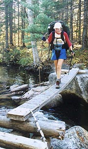
There�s a couple of crossings marked as fords, but they�ve both been bridged with rudimentary planks
and such; but Coleen tires quickly, wanting a break. We stop just before Big Niagara Falls, giving
a short pep talk on enjoying our final hike and such; and it works, encouraging her to savor the
day. There's a quick stop at Big Niagara for a pix, and from here on we begin to see increasing
numbers of tourists coming down from the park on short hikes.
Soon we come on a junction, the AT heading left and a nature trail to the right � various journals
suggest the scenery of the right branch, but we stick to the official AT, which quickly turns into a
muddy mess, with no views whatsoever. Passing Daicey Pond, there�s a bulletin board, parking lot,
and privy; but no sign of a Ranger Station, so we continue, our knees both hurting badly as the
trail goes up and down, up and down in the trail�s final PUD�s. It�s a relief when it finally comes
to a dusty one-lane road for the final roadwalk � even though we have to dodge traffic and cough
through the dust, at least it�s easy trail. It�s marked as a half-mile (seems much further) but
finally we come to the sign � it�s Katahdin Stream!! A short walk down the road finds the Birches,
where all our partners (save Blip) are assembled, the ranger having come by and told them that he�d
check back later. We�re told that Blip�s boyfriend Ed is here and is agreeable with driving us
along - in fact we actually passed him on the trail, as he headed down to join her. We chill for a
bit, and soon they come hiking in � he�s a good guy, and seems like someone we can work with,
although with the ample tenting space here, we all wonder if we can wangle our way into putting an
extra space right here.
The ranger comes by after a bit, and we all head over to sign in � when Blip and Ed go to plead
their case, we find that a space or two here appear unoccupied. The ranger feels confident about
one (space 21 � the only one with a view of Katahdin), and finally tells us to go ahead and camp
there if it�s open � he�ll come over later to collect the fees. This is great news, and about this
time the cavalcade of hikers coming down from Katahdin begins � it�s a nonstop series of reunions
for most of the group (we'll meet the popular Moo & 42 - we�ve read them a lot in the registers, but
never met them before).
| The fall foliage is even more spectacular inside Baxter
Park |
|
| Katahdin looms large, but it's still hard to believe
we'll summit it tomorrow. |
|
Finally, a bridge vs. a ford
|
|
 |
Ed breaks out his cooler and camp stove, treating us to beer and sodas, and beginning the hot dogs,
which he's amply supplied. We join them for our "last supper", with Tank and Willow coming over to
use his grill and contributing some Doritos, ourselves breaking out our supply of candy bars to
contribute to the feast. We chat over the picnic table as night falls (Ed�s a medical sales rep
from AVP), and it seems everyone�s bent on an early launch tomorrow, Ed asking me to wake him at
5:30 as he expects a slow climb. We pack our gear in prep for leaving a garbage bag full at the
ranger station, and turn in at an early 8:15 with the nearly full moon streaming over our tent ,
although we�ll be awakened after an hour or so by the squirrels furiously trying to get into our
hanging food bag, which we then move inside the tent (it'd be damned ironic being a victim of a bear
attack our final night on the trail).
| Chilling at The Birches before our final climb
|
|
10/12 Katahdin Stream - Mt. Katahdin
(5.2 miles)
"We few, we happy few, we band of brothers;
For he today that sheds his blood with me
Shall be my brother"
William Shakespeare - St Crispen's Day Speech
We're up a few moments before the 5:10 alarm, anxious to get around for our final day on the AT.
There's little prep to do - mainly stowing our unneeded gear into a garbage bag for storage in the
ranger's station, and promptly at 5:30 the day hikers begin pulling in to the parking lot, with many
of the tenting spots around already lighting up in the pre-dawn. Blip & Ed are up as well, and the
first dark shadows of hikers are already starting up the trail towards our goal. I drag the mammoth
garbage bag of our unneeded gear over to the office (can't believe we carry all this stuff), and
we're afoot early, signing in at the sheet at the trailhead at 6:09 as we head up, giddy with
excitement.
|
| The soft dawn light bathes Katahdin Stream
Falls |
Sunrise welcomes us to the boulder field |
|
|
We start slowly, savoring our final day even before sunrise, and soon we're passed by the typically
sedated Lion King, carrying a video camera for an alleged "documentary". We leapfrog him at the
Katahdin Stream crossing, as he drops much of his gear (sounds a lot like beer cans). Dawn breaks
quickly after we pass the beautiful Katahdin Stream Falls, and soon after the climb steepens, as
does the trail's roughness, quickly becoming a thin track filled with boulders of increasing size.
Our crew begins to pass us in typical order, and soon we're scrambling up long steep granite slabs -
barely within the traction of our boots. It's getting tough quickly, and as Lion King confirms, the
fun's just beginning.
With 3 miles to go, we climb into the krummholtz and thence above treeline, the bouldering now more
challenging than any we've yet experienced on the AT. A couple of particularly tough spots sport
iron rungs driven into the rock - even here they're far too few, and on one particularly tough climb
I have to give Lion King a boost up (though Coleen and I manage it without help - barely). My pack
frame is often in the way, and it takes quite a pounding as we wrench over and around the massive
boulders searching for fingerholds. Finally the boulder field eases as we climb onto a narrow spine
of fracture rocks heading up to a pinnacle - this must be the Gateway. 
|
| The boulder field - now the real fun begins |
Thoreau Spring in the Tableland - only 1 mile to go!
| |
 |
It's still tough climbing, but easing considerably, and soon we pass a sign showing two miles to go.
By now the day hikers are joining us on the slopes, many of them European, and most fairly fit (as
we would be were our knees not so beat from the last week). We top the Gateway, and before us lies
the Tableland - a tundra-like wasteland of alpine scrub and more moderate slope, giving us a view of
the summit for the first time. It's beautiful on several levels, and not just because of the
moderating climb and our quest's nearing completion. Soon we pass the expected Thoreau Spring (not
much of a spring - mainly makes the trail muddy) for our final mile. As we're doing the final
climb, we spot the sign, a small crowd assembled around it, and climbing the final spine to the
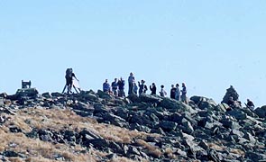
summit, we hear the shouts from above, our cheering section spurring us on to the top.
| Our 'cheering section' waving us in from atop
|
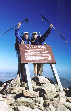
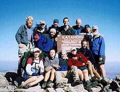
We reach the sign amidst a chorus of shouts and cheers from the familiar gang, with a host of
congratulations as we walk up to touch the sign at 10:12. Coleen breaks out in tears as we do
(Kilroy admits to doing the same moments before), and several of our group are celebrating with
cigars, others with whatever food they were willing to carry across the wilderness. There's
pictures to be taken, and I deposit one of the two rocks I'd carried from Mt Springer as is the
custom. There's still no sign of Blip and Ed yet (we'll pass them as we start our descent), but
everyone's anxious to see family and friends at the bottom, so we assemble the gang for a group
photo, finding several day hikers to hand a pile of cameras for the pix. The spirit is one of
elation for all, but even though many have no idea what the next chapter holds for their lives,
we've all got people down below with whom we're anxious to share the moment.
Epilogue
"Then wilt thou not be loth
To leave this Paradise, but shalt possess
A Paradise within thee, happier far.--
Let us descend now therefore from this top
Of speculation; for the hour precise
Exacts our parting hence;
Some natural tears they dropt, but wiped them soon;
The world was all before them, where to choose
Their place of rest, and Providence their guide:
They, hand in hand, with wandering steps and slow,
Through Eden took their solitary way."
John Milton - 'Paradise Lost'
It's a bittersweet feeling leaving this hallowed ground - we climbed up as Wildfire and Wounded
Knee, but we'll descend as plain ol' Bob and Coleen. Though the view down from the Gateway looks
knee-wobblingly steep, it proves far easier and faster than the climb up (we're able to jump down or
slide down many of the tough stretches). Luckily, it's a gorgeous autumnal day outside, easing some
of the sadness we feel at closing this enthralling chapter of our lives. Back at the campground many
of our group are reuniting with family and friends, and a couple hours later in Millinocket, we'll
run into Monk, Riffraff, and another hiker out front of the AT cafe. It's tough saying goodbye to
our new-found friends, many with little idea where the next year will find them.
So how does one sum up this quest? It's odd - a four year chapter of our life now closed, and yet
it went by like the blink of an eye. Our foremost goal was to capture some shared memories into our
marriage; and on this score we succeeded in spades. Even back in our home life, rarely a day goes
by when we don't find ourselves saying, "Remember that time on Franconia Ridge when.....?"
|
|
| Victory!!!! |
 |
| The bittersweet descent back to the real world
|
 |
It's been an unparalleled education, equal in par to the four-plus years we each spent in higher
education. And like our college years, the most important lessons were learned at the hands of
friends we've met along the way. We've learned that we worry far too much, we've learned the joys
of a simple lifestyle, and we've been amazed by the boundless hospitality of strangers. Though
we've enjoyed the occasional solitude, it's the people we've met who are the real crown
jewels of the AT.
The words that keep returning to my mind are "The Agony and the Ecstasy". Every day we suffered and
wearied of the trail, yet every day had its ecstasies, some as simple as finding a clear and cold
spring - others so spectacular as to defy words and bring tears to our eyes. We've often wanted to
quit, but somehow we found the strength to go on; tucking into our sleeping bags each night, and
nodding off dreaming of a mountain in Maine called "Katahdin".
The dream became reality at 10:12 am this morning, October 12, 2003.
Wildfire & Wounded Knee
| Our summit group (Missing Blip) - from left rear
clockwise, Viking, me, Last Minute, Willow, Tank, Monk, Kilroy, ChillyWilly, Cruisin, Indigo,
Rifraff, Scabs, and Coleen
|
| | | | |


