The Challenge
¤
Dogged persistence the victor over flawed judgment
Great Barrington, MA - Stormville, NY
Back in the "real" world, my workday transition to the DC-10 nears its completion, with a month-long hole in my schedule before the final phase of training. Seeing a similarly long hole in our AT map (between MA and mid-NY), the two seem a good fit, though a quick calculation finds it a long 97 mile trek. Still, we have the time; and it'll be a good test looking ahead to the legendary "100 mile wilderness" we'll tackle at the trail's end. And hey - it's Connecticut - how hard can it be?
|
6/17 Great Barrington - Hemlocks shelter (16.4 miles)
"Don't be afraid to take a big step. You can't cross a chasm in two small jumps."
David Lloyd George
From our NY hotel room, we wake to the all too typical sound of pouring rain outside, punctuated occasionally by lightning and thunder. After breakfast at the hotel with some girls' soccer team we make the quick trip over to Ralph's (our shuttler), finding Ralph surprisingly normal save his new bushy blond hairdo. With ourselves, he's shuttling Ron and Gary - a couple section hikers from our area who just finished the section from Cornwall CT to here over the long weekend. After dropping the guys at Cornwall we shove off for Barrington, and after pleasantries, we're off in a light rain at 10:35. In no time at all we have to stop and slather ourselves with DEET, finding it surprisingly effective against the swarms of mosquitoes surrounding us (though they quickly find any holes in our armor). We start passing northbounders almost immediately, and over the next few days we'll pass thru-hikers almost hourly. The trail soon hops uphill, though after a bit of a climb comes a strange turn taking us back downhill to parallel the path we took up. I'm skeptical, the map not showing the turn and our compass confirming we're heading north in the mist, but we continue on the white blazes, soon running into a older follicly-challenged fellow sweating his way uphill.
|
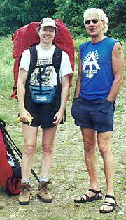 |
| Ralph, aka "Elvis Trailsley"
|
He's come from Wilcox shelter, which confirms we're going the wrong way (we stayed here during our MA section), so it's about face, pulling away from him as we head back up the trail. Soon we reach our point of confusion and see our error - we'd actually been on a side trail heading uphill. At the Tom Leonard shelter, another section hiker sits on the picnic table, his tent erected in the shelter. He's taking a day off here, with no particular destination, and soon the fellow we'd run into pulls up as well. We find the latter to be Bob from NY, also heading south, from Goose Pond to Hoyt Rd on the CT / NY state line. After a modest break we head on, hearing Bob and the other hiker here chatting loudly for some distance. The trail descends back to the lowlands for our first crossing of the Housatonic, but surprisingly the pastures and marshes here are quite pleasant and not very buggy (contrary to what a couple of northbounders had told us - each looking like pincushions for the mosquitoes).
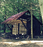
After a short marshy walk we pass Jug End Rd, where our day's climb begins, so we sweat our way uphill, with a longer break halfway up as the steep climb wears on us. Finally we're atop, with great overlooks in the clearing weather, trudging on towards the shelter, for which we finally find a sign at 8:15. It's a long walk down through a hemlock grove to the shelter - clean but very basic; so as Coleen bathes in the adjacent creek (a beautiful clear cascade), I go back up to check out the tent platforms and the Hemlocks shelter - a mere .1 down the trail allegedly. The platforms look good, and I go on to check out the Hemlocks shelter, continuing south quite a ways before giving up and turning back; though in the fading light as I return I barely see the sign, oriented so only a northbounder could see it. It's a much bigger and better shelter, so I take my report back to a revived Coleen, with much effort getting her packed for the move.
Finally we're there, and I head back to the creek for my bath as Coleen starts dinner and attempts to build a fire, although I end up doing the latter myself (had to use birch bark, as everything was a bit damp). After some refreshingly cold water we have dinner and a round of hot drinks as the evening cools. We turn in at 11:30, though I have a tough time getting to sleep due to a sore area on my back from a misplaced pack webbing.
6/18 Hemlocks - Salisbury (Maria McCabe home) (14.1 miles)
"The bond that links your true family is not one of blood, but of respect and joy in each other's life. Rarely do members of one family grow up under the same roof."
Richard Bach - Illusions
Coleen sleeps well, but I have a tougher time with the cool temps, my thin fleece bag proving little comfort. Still, it's a great day - clear with vastly reduced humidity; and we're out at 8:00, with a quick stop by the other shelter to seek my lost comb. Here I run into Bob, who couldn't find anywhere to stay in Sheffield, and pulled in here after dark. It's good to see him again, though he's not yet ready to leave, so after I give him some needed data, and we're off again. We start the day's big climb up Mt Everett, not too steep, but long and steady. It's a relief to hit the decrepit fire tower at the summit (the lower race of steps have been removed to keep us off), but from here the trail turns back downhill, the descent proving steeper than the climb. The blazing is poor, and between this, the rocky trail, and the steep terrain our pace is glacial.
| 
|
|
|
Our next climb crosses Race Mt, taking a long break at the crest as we meet Straight-Tail, Canine, and Brain; the latter a friend of Bob's. Bob catches up and chats with them a bit, hiking on with us afterward, as we find his motivations and goals similar to our own. The trail atop Race is marked by a number of good overlooks, some with sheer dropoffs below, and thence it descends through the beautiful Bear Rock Falls campsite where we all stop for lunch on a tent platform. Seeing Bob's food, we understand his 55# pack, and after sharing a little of his summer sausage and our jerky, we linger a little at the waterfall flowing through before resuming the trail towards the Sages Ravine campsite. Shortly after, the trail turns back uphill for our day's final climb up Bear Mt.
It's a steep ascent, with many vertical rock steps and slabs, and we're very glad to finally reach its summit, where an eroded monument commemorates what was once thought (erroneously) the highest point in CT - now it's more a monument to poor surveying. After this, the trail is a featureless wooded path until reaching Brassie Book, where we stop for a quick water filtration. Our next break is at the Riga shelter - famous for the beautiful sunrises, the sun peering into the shelter unimpeded as it rises each morning. It's a good shelter, but we intend to go further, so it's a quick break here, with Bob pulling up just as we're leaving. He's pretty winded, with no intent to go further, so after a brief adieu we head on over Lion's Head, starting the descent to Salisbury. Though I'd hoped to get further, it now appears this will be plenty for the day, making a Friday completion uncertain. Coleen's feet are hurting badly though, and passing the Plateau campsite, we find a group of 3 thru-hikers hitching in on CT 41 for beer. We continue the trail to CT 44, passing through a nice hemlock forest and behind one very upscale home with a spectacular view from between a couple of giant boulders. Obviously if we can't make our planned connection (staying with Maria McCabe, a 71 year-old widow who rents rooms to hikers), we could probably stealth camp here.
At 44 we turn into town, Coleen wanting to hitch even though we can already see the Hart Inn. She tries it half-heartedly once or twice, but soon we're there, passing the Inn with a confused look as we spy a local celebration at the adjacent ambulance garage, with one lady beckoning us over. It's an open house for their 30th anniversary, and we're invited to share hot dogs, chips, punch / tea, and cake - an invite they needn't extend twice. It's a good time chatting with the hosts, although no one's very sure about who Maria is. Soon we're stuffed, and I find a phone to call Maria, who lives a mere 4 houses down the street! As I head back outside, I find everyone has figured this out, several yelling out to me as I work my way back to Coleen. After abundant thanks, we head down to Maria's, where she's waiting on us, yelling as she sees us approaching the yard. She's a lovely elderly German lady, though as she told on the phone she's suffering from bronchitis, and hasn't been upstairs to clean. Still, she offers a pile of linens and towels, and we find a great room upstairs, a bit stuffy, but with an AC and cable tv, which I peruse as Coleen heads straight for the shower. I'm next, with Maria retiring early downstairs as both of us watch 'Into Thin Air' on tv, tiring quickly and turning in at 10:30.
|
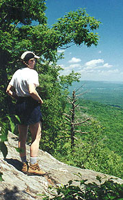
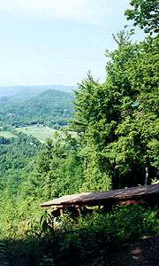
| A Race Mountain overlook
|
|
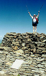
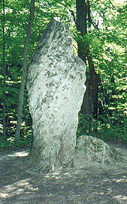
A monument to poor surveying - once thought CT's high point
|
6/19 Salisbury (Maria McCabe home) - Caesar Brook campsite (19.1 miles)
"Little things console us, because little things afflict us."
Blaise Pascal
|
| We're up early, heading down to the kitchen to make coffee with our own breakfast (Maria offered us eggs and OJ in her fridge, and we take her up on the latter). To our surprise, Maria's up before we head out (she'd trusted to just leave the money on the table). After a quick chat (wish we could have chatted more), we're on our way at 8:00, being besieged by mosquitoes immediately on entering the woods. We keep them at bay as we climb Barrack Matiff, but they besiege us as we stop at Giant's Thumb for a pix (recalling George Steffanos's comment, " I hope that Crazy Charlie hiked this section of trail. That giant thumb would have been a wonderful inspiration to him, celebrating, as it does, his favorite means of AT travel.").
At Rand's View we suddenly emerge from the woods, with a beautiful vista of the mountains as far as Greylock from this alpine meadow. A family of pheasant greets us, the mother running off on foot to draw us away (one of her new youngsters following, having missed the briefing on this ruse). We DEET up as we enjoy the view, returning to the woods up Prospect Mt, where the shade, lack of bugs, sitting rocks, and a fellow hiker coerce us into a break. He's also a mosquito victim, and as we descend we pass a northbound couple in similar distress. Here the trail takes a gradual descent to the Housatonic River, which we reach at Great Falls - at low flow now, but still an impressive rock formation. It's great trail here, passing the power plant and making brief stops on the nature walk, but forging ahead in hopes of a town meal. The nature walk is a wonderful stretch of trail, but at Warren Turnpike we realize that we've overshot the Fall's Village pizzeria, so it's deli food for lunch. It's a depressing trail to the deli, with a level roadwalk on our left, a railroad on our right; yet we wallow up and down continual hills on the trail. Finally we break out on the road, the beautiful Regional High School in view ahead (the requisite traffic accident out front), and here a couple of teachers out for a walk give us crude directions to the deli.
|
|
| Giant's Thumb - a natural rock formation
|
After a short walk we find the Fast Track Deli is now the Mountainside Caf�, sporting an adequate menu, though it's very stuffy with abysmal service. The food's OK though, and by some miracle we get a refill on our DC's, tanking up our water bottles in the lav. Our return to the trail takes us to Rt 7 at CT 112, where the trail architects have planned a cruel joke, routing the trail in a loop around a corn field, which :10 later emerges back on the road only a few yards away from our entry point. Here we re-enter the woods, climbing and sweating as the afternoon warms, reaching Belter's campsite with rivers of sweat running off us. The trail affords a brief overlook of a majestic estate poised on another mountain just a few hundred yards off, and we have a brief encounter a small boy, his mom, and a very aggressive unleashed dog - my hiking staff keeping Cujo at bay until mom leashes him.
|
|
Sounds of screeching tires and howling engines below make us think it must be the last day of school (having already seen one crash there), though as we come up on the Hang Glider View, we see we've been hearing a race track below. It's a good place for a break, chatting with another hiker on a 2-month section hike as we do. We want to get to Caesar Creek tonight though, so we push on at high speed, a couple moderate climbs yet ahead. There's one last feature of interest - Roger's Ramp, a long thin simulation of the "lemon squeezer" we remember from NY, although it's wide enough to leave packs on. Finally we reach Caesar Road, with a clean brook just beyond, and a decent campground on the opposite side, though it quickly proves buggy. It's too late to go any further (besides, we're spent), so we do last night's routine, Coleen bathing as I set up the tent and start dinner. On her return, we swap roles, both donning long sleeves against the mosquitoes. It's not bad, but soon we're ready to fly the food and retreat to the tent, shunning the rain fly for ventilation (it's still stuffy inside). After catching up on the journal and such, it's taps at 10:30, although sleep proves elusive.
6/20 Caesar Brook - Rattlesnake Den campsite (16.8 miles)
"Character cannot be developed in ease and quiet. Only through experience of trial and suffering can the soul be strengthened, ambition inspired, and success achieved."
Helen Keller
|
Hang Glider launch
Glad our runways aren't this steep!. |
The birds rouse us at first light, with the mosquitoes complicating our prep a bit by, getting out at 07:56. As we're breaking camp, a northbounder comes to use the privy, an exposed one just next to our camp. It doesn't dissuade him though, and he's still in the 'Rodin's Thinker' mode as we hit the hills (it's astounding how great the trail is at shedding inhibitions). After climbing over Pine Knob we descend to Guinea Brook, a powerful cascade in the morning haze. Also here is CT 4, where many AT hikers hitch into Cornwall for the free beer that's offered them, though we're more interested in miles than beer at this hour. Heading uphill to the Silver Hill campsite, we hear an odd species of woodpecker common to the area - his pecking begins at a moderate pace and slows to a Morse code rhythm rather than the usual staccato. We pass a herd of northbounders just leaving Silver Hill and there find a wonderful campsite, devoid of bugs, with a pavilion, picnic tables, and a pump with potable water. After a long break, consuming gallons of the cold water, we start the descent to a 5 mile river walk along the Housatonic.
It's a nice walk, with few bugs, a fair view of the river through the trees, and easy path, though as the temp and humidity rise it gets sultry. After lunch in a defunct red pine plantation we return to the mountains, our first climb being the renowned St John's Ledges - a popular area for rock climbing. This climb is well known as a knee-breaker for northbounders (for whom it's a descent), and it's a killer climb for me in particular. Rivers of sweat roll off as this steep climb continues endlessly, and I ponder what St John could have done to merit this little slice of hell as his namesake. Finally the torture ceases, and the subsequent climb over Caleb's Peak seems mild by comparison. The trail continues through some ups and downs before a steep descent to CT 341, where many hikers hitch into Kent. Crossing the short meadow and Macedonia Brook's bridge to the road, I notice a small thunderstorm building behind us, though it doesn't look threatening.
|
We've barely enough steam left for our final two climbs, passing up the Mt Algo shelter as we forge on to Rattlesnake Den to ensure our Fri completion. We take it slowly, the summit of Mt Algo followed by a short descent to Thayer Brook and an incredibly steep-looking climb and descent over the unnamed mountain after. It's far easier than it looks, though as we cross, the thunder booms to our north, closing on us by the minute. It's a race for the finish and we lose, the deluge breaking forth while almost an hour out. It's a potent storm, with one deafeningly close bolt of lightning, though we're well below the crest, so we don't feel too imperiled. With pack covers on we hunker down and hike, with Coleen suddenly yelling from behind that I narrowly missed stepping on one of the biggest pilot black snakes she's ever seen (he just sat there calmly). The rain does cool it down (though amazingly, it doesn't stop the mosquitoes from biting), and finally we reach the campsite, finding now that the tent sites are up a steep incline from the trail. Worse, as we climb up over the wet and slippery rocks, we see the best spot is occupied by a large tent filled with shrieking teens. We settle on the #2 spot, but as we stop the mosquitoes attack with religious fervor.
The tent goes up quickly, though the swarm of mosquitoes around dissuades me from opening it any more than necessary, so I let Coleen bathe as I move things into the tent and start setting up for dinner. It's an exercise in frustration trying to keep everything dry and not to get eaten alive at the same time. Finally I end up in the tent with the essentials, the mosquitoes hovering outside in swarms, waiting for even the smallest corridor. Finally I head down to trade places with Coleen, doing a very perfunctory cleaning before donning my jacket to keep the mosquitoes off. It's sadly lacking, so I add the mosquito netting over my head, tucked in my jacket, with Coleen following suit - an inconvenient but effective alternative. We get dinner cooked and quickly tidy up outdoors, retreating within the tent early, with lights out at 10:15.
|
|
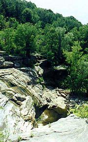
| The Housatonic River at a point of low flow
|
6/21 Rattlesnake Den - Wingdale NY (15.4 miles)
"Illegal aliens have always been a problem in the United States. Ask any Indian."
Robert Orben
|
| The birds wake us again at first light, although we sleep in until 06:40, finding the mosquitoes lined up and waiting outside the netting. Our gear is now all damp and our clothes a bit funky, and watching the mosquitoes swarm I can't help but reflect that we're now in the midst of the only Indian reservation on the AT (Schagticoke), saddened at the worthless places we offer our native predecessors. Coleen needs supplies, so I suggest a trip in to the Country Mart at Bulls Bridge, a mere 2 hours down the trail. After a short climb over Schagticoke Mt, it's mostly downhill, although on arriving at the road, we find a relo has turned it into a full 1/2 mile into town. It's still a pleasant walk though, crossing the Housatonic on a beautiful colonial covered bridge.
The Country Mart is hiker-friendly, and we splurge on some expensive sandwiches for lunch, the requisite D/C's, and a pint of Ben & Jerry's for our break. After a long break on the picnic table we chat a bit with the counter girl about hikers, she offering to slack us (take our packs) up to Kent on her way home - wrong way for us though. Back to the AT it's a nice forest walk (they're all a little nicer after Ben & Jerry's), joining the Housatonic, and up the rushing Ten Mile River. The trail turns up Ten Mile Hill (a few feet short of the 1000' needed to be a mountain) on a long, gentle climb, followed with an easy descent through the misty morning towards Hoyt Road and our completion of CT. We wanted to leave a note on Bob's car, but he's parked next to a truck (tag LACEE1) with a guy getting a nooner from a topless girl within, so with minimal intrusion on their privacy we head on, resolving to E him later.
The NY section of the trail is far more unkempt than CT, with long wet grass intruding on most of the trail, plus some daunting thorn bushes often covering the trail - even to shoulder height and above. It's impossible to hike without getting soaked and scratched, and after Duell Hollow Creek, it's a relief to see the path turn uphill into the woods. We lunch at Wiley Shelter, where the caretaker has assembled more pans, papers, and gadgets than any I've yet seen (though it's a good chance for me to dry my feet a bit). It's an easy forest walk from here, passing a large stone and iron portal marked as "Heaven's Gate" and following a road where we find a lost northbounder glad to see us. We solve his navigational dilemma but create our own, as the blazes soon disappear, making us turn back to find the trail. We finally find where the undergrowth has covered the turnoff into the woods, but not before the mosquitoes assault us again, requiring another coating of DEET.
The trail enters a marsh with miles of puncheons, with various trails diverging from the AT. It's boring and demoralizing, and Coleen soon demands a break on a nearby log, me standing adjacent myself as long as the mosquitoes allow. The trail finally emerges from the marsh into a series of pastures, where we consider tenting, but now feel more like the upcoming Duchess Motel, showing a $48 rate in our guides. The pasture walk continues for an eternity, but finally we see the old water tower, and thence NY 22 where we intend to hitch. It looks like a great place for it, with a parking lot for a pull-off just past us, but we estimate over 100 cars pass with no one even slowing down. Finally a decrepit pickup truck (bed full of gardening junk) pulls over, driven by Mary Ann. With a little rearrangement I hop into the back as Coleen takes the front, and we're whisked off to the motel, with me hanging on to my cap, my pack cover and various items from the front seat I've been handed to make space for Coleen.
In a few minutes we're there, given an admonition by Mary Ann to pay it forward, and at the office we find the owner, standing in the kitchen clad only in a pair of shorts. He tells us our prices are outdated, the new rate being a confiscatory $73. It's outrageous, but we're glad to be under roof, and he promises a dropoff at the trail tomorrow, eliminating one riffle. The room is fine, with a fridge, a huge comfortable bed, AC, and cable tv; and on settling in Coleen starts drying our smelly clothes as I search out a source of food. A couple places deliver, and soon I've got an order in (Italian), as Coleen bathes. The delivery boy shows as I'm finishing my bath, and we dine on calzones, watching Shawshank Redemption on tv, and finally turning in at 11:10.
6/22 Wingdale - Stormville NY (15 miles)
"Ad Astra Per Aspera"
(To the stars through adversity)
Kansas State motto
|
|
We're up at 06:00 to start our final day, and after a quick breakfast, we head to the office for our dropoff. It's another gray morning, with ominous dark clouds to the west, but somehow they never break into rain. After passing across the AT train station (nothing more than a small platform), we skirt the edge of a large swamp before climbing into the woods. The trail is most uneventful, though climbing out we hear a number of sirens below, repeated over and over (never figure out why). The Telephone Pioneers shelter passes uneventfully, and soon our "major" climb for the day up West Mt is complete, with a gradual descent after. The cavalcade of northbounders begins, including the British "Dell", who's hiking the ECT from Key West to Gaspe and beyond, having been out 11 months already. Soon we pass the north side of Nuclear Lake, where plutonium was once refined and the butt of many jokes and apocryphal stories (though now declared safe by every possible authority).
|
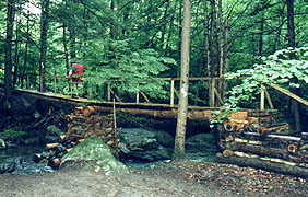
A beautiful bridge over Whaley Lake Stream |
Diverging from the lake, we find a convenient rock for lunch, with Coleen leading from here to the Morgan Stewart shelter, where the skies begin to clear up. The roar of I-84 becomes evident, with the sun blazing as we cross overhead, a short roadwalk taking us through overgrown fields and woods for the quick section over to NY 52. Here's a sack with apples and water left from a trail angel (always happens when we don't need it), and now we're counting down the minutes to Ralph's. A bulletin board on the south side of 52 sports a newspaper article about Ralph and Kathy's service to the trail, and after a quick read we march on, reaching the familiar ring of cairns where the trail passes his house. From here it's the 400-step path to his house, which seems longer today, but soon we're there, our car just as we left it.
Our hike is done, but the adventure far from over. Driving away, we see a familiar biker, who on closer inspection turns out to be Ralph coming home from work - we pull up and chat for a moment before excusing ourselves to go in search of food. Our drive home takes us through great and mighty thunderstorms, finding our development filled with repairmen fixing downed power lines and such. Even back home, we find our phone line dead, along with a host of oddly behaving appliances; and the next morning we'll find a tree in our back yard reduced to matchsticks by a stroke of lightning. Our neighbors are all too eager to tell of the excitement we missed, and our own stories of dodging thunderbolts on Schagticoke Mt pale by comparison. Timing is everything.
| |


