|
The Seasoning
¤
Eased by kindred spirits on the way
Dick's Creek Gap GA - Wesser NC (The "NOC")
January is a bringer of new
things - a new year, a new century, a new millennium, and the great
joke of the 20th Century - the Y2K scare. On
reflection it's laughable - if
the heat fails, it'll still be warmer than our tent; if the water
fails, we'll take our filter to the stream behind the house; if the
power fails: well, frankly if all three of these fail it'll still be
far more comfortable than the trail. Counting ourselves worthy of
the AT winter, we set a southerly course, bound to
complete the state of GA.
2/20 Dick's Creek
Gap-Muskrat Creek Shelter (11.6 miles )
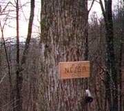
"The AT - where it's uphill to everywhere."
sign
in Bear's Den hostel It's a frosty morning as we pull in
to the NOC (Nantahala Outdoor Center) to meet Agnes, our shuttler. Quite the
talker, her stories reflect some
ancient attitudes of the deep south - a few that take us "Yanks" quite aback.
We're afoot
by 8:58, starting with a well-graded climb up Little Bald Knob
(as the road accesses are always in gaps or mountain passes, our
hikes always start with a climb). We've found the 1st climb of the
day is always a "freebie" - we're envigorated and in winter it's a welcome
warmup.
So it is on this gorgeous crisp day, with skies of the deepest blue; and it's
my 1st opportunity to try my sleevelets - a pair of
sleeves cut out of a long underwear top that can be put on
without removing my pack. We're being
snowed upon in spite of the clear sky, and inspection find
the trees above shedding frost in dainty flakes as the
temperature warms - a magical sight.
|
| The route is full of
the deep greens of rhododendron and mountain laurel, and it's great hiking. We
soon
pass our 1st other hiker - "Redness Rushing", who started a
thru-hike last year before falling victim to the "Virginia blues",
and is now completing the GA section.
At Plumorchard Gap, a couple hikers overtake us
with great speed - Energizer Bunny & Downhill, part of a group of 8
that assembled on the internet to hike the AT together. He's
retired military; she did a flip-flop hike (see AT Q&A page)
over 2 summers before; and they've outpaced the rest of their group
who are slowed getting away from the Blueberry Patch hostel.
They seem like good folk, and before the weeks's
over, we'll leapfrog with them for the entire section.
After lunch it's a easy, well-graded path, passing a
few trail workers just prior to the GA state line.
|
|
| We're sad to leave GA behind,
but we've 12 states left. |
| There's a bittersweet quality about
finishing GA, our first major state to complete. There's
a sense of accomplishment, but there's also the sense of loss
- the good times we've enjoyed here, the things we've learned, that
feeling that we may never again hike this beautiful and seminal section
of trail. Though the GA/NC sign is easily
overlooked, the NC trail planners have prepared a much more
impressive welcome. It is Courthouse Bald, still invisible behind a
small rise to our left. After a quick break (EB & Downhill
catch up and take their break here) we cross the small rise, turn
right, and immediately see Courthouse Bald looming in our faces.
The trail marches straight up the side, devoid of switchbacks in a
game of brinkmanship between the NC and GA trail planners, as if to
say: "That's not a hill - This is a hill". It's all it
appears and more, with several illusions of success, only
to find the real summit lies yet beyond. Worse, a hot spot on my right
heel is becoming a substantial blister, so I duct tape the area
(poorly), and continue in pain on the ups. At the top
is a welcome downhill to Sassafras Gap, and finally a gentle,
relaxing climb to Muskrat Creek Shelter - lying just off the
creek it seems an ideal stop for the night. EB
& Downhill join us shortly, deciding on tents vs
the shelter, and as the evening's chill sets in, we follow their lead
(the tent is about 10° warmer than the open shelters). Once the fire
is going, I set up the tent as Coleen cooks, making cups of soup and
a Lipton rice dinner (the rice ending up
crunchy in the bag, so we abort to
finish it in
the pot). EB & Downhill, on the other hand, prepare a gourmet
feast, with tomato sauce, canned tuna, and grated cheese over the
top. It all looks good, but heavy to carry, making our small repast
look very Spartan. They offer to share, though when we decline,
they clean it all out not leaving a crumb. We find EB a confident
sort, having hiked the upcoming section in Sept, and a former
private pilot as well. Downhill began a southbound thru-hike a few
years ago, but when the cold set in, she deferred the bottom half
until the following year. They're good folk, and we chat around the
fire till the cold drives us to our sleeping bags, getting to bed
by 8:00.
2/21 Muskrat Creek Shelter - Little Ridgepole Mtn
campsite (14.5 miles)
"How many times it thundered before Franklin took
the hint! How many apples fell on Newton's head before he took the
hint! Nature is always hinting at us. It hints over and over again.
And suddenly we take the hint."
Robert Frost The
night was a beautiful but cold one, bright as midday
under the full moon; though sleep was tough. Our campsite's slope
kept us sliding down towards the door, and Coleen was cold despite
all our leftover clothes draped over her. We're up
at 07:00, with extra joe to stave off the cold, and don't
get away until a late 09:30, though we're trying hard to get to
Franklin in 3 days for a town night, a strong
incentive. We're powerfully hungry today, and our
first break occurs in just a mile, at the Chunky Gal trail (apt for
us, if we keep taking breaks this frequently). We settle into a good pace
(the trail is level and
mercifully hard frozen, lest it be mud). It's also full of the
small, magical "ice pipes", and I snap a pix in hopes of showing it
to someone who knows the correct name for this common feature.
At Deep Gap we start the long but well-graded
climb up Standing Indian Mt, passing EB & Downhill
heading back south, having left something at Deep Gap.
Lunch is midway up the mountain, and
we make good time on the pleasant path, now adorned with
frequent hemlock glades, the
occasional grouse hiding within. We
stop for water at the Carter Gap shelters - both the new and the old
remain (set in a beautiful coniferous forest - we hate to leave, but we
need a few more miles). The spring is far further downhill than I'd like, and
I'm
freezing as the evening chill falls, but we take a moment to leave a note in
the
register for our pals before continuing.
The trail soon becomes a small level tunnel through a dense
rhododendron thicket, and while it's great
hiking, it's too dense for camping. Soon the ridge
widens though, and after a little search we spy a perfect area off in the
trees, with a level
tent area, a fire ring, and a huge sitting log just along the edge
of the ridge. It's our perfect idyllic campsite, with
calm winds, clear blue skies, and shimmering lights from the valley
as the sun sets in the
west and the moon rises in the east. Firewood is plentiful,
our tent is up (though one of our tent poles
breaks, making me lash a stick to it for support), and soon
the water is boiling for our chicken teriyaki dinner. We can't get
over what a nice site it is, and how great it is to savor the beauty
without wind. We really enjoy sitting
by the campfire at night, and tonight Coleen breaks out her
marshmallows to roast with our cocoa. It's so serene that we don't
retire until 10:00, dreaming of a town day tomorrow.
|
|
2/22 Little Ridgepole Mtn campsite - Franklin, NC
(13.9 miles)
"There came at night into that lodging-place
twenty-nine in a group of sundry people, by chance fallen into
fellowship, and they were all pilgrims wanting to ride toward
Canterbury."
Geoffrey Chaucer, The Canterbury
Tales After getting up once at 05:15 (with the brilliant
moon I can't tell if the sun's up or not), we're up for good an hour
later. I have to drag Coleen out, but the hope of a town day helps,
and the sun rises in a thin band of blue sky to the east, though soon replaced
by a dismal gray.
Today's challenge is the climb of
Albert Mt, a short but steep climb that proved the first Waterloo
for Bryson (in his book, A Walk in the Woods - he and Katz end up
taking the logging road around it in the snow).
We slab the side of
Big Butt Mt. on a precipitous trail of minimal width, often with
vertical drops of over 100' just inches to our right. It recalls
the Pinnacle trail we used to hike in Bar Harbor ME, and the rock
face on our left is covered with luxurious green and red dripping
moss. Though overlooks are frequent, it's too hazy for good
pix, and soon we leave the cliff face and return to the woods, with
one last break before the assault on Albert.
Now the
real climb of Albert begins, all we'd expected. At the base a few steps are
cut into the
hillside - to the uninitiated these might indicate a well-prepared
path; but on the AT, they mean the opposite - the
path too steep and unstable to negotiate any other way. The step
pitch is tall, and it quickly turns to a rock climb. It has good
hand and toe-holds though, and only a short portion requires our hiking
poles be stowed to use all fours. By 10:30 we're
atop the summit, taking a few minutes to climb its fire tower. The
observation deck is padlocked, but even from the top of the stairs
we have a panoramic view. Still,
we've miles to go, so we're off, stopping at Big Spring
shelter to replenish our water. From here it's a gentle descent (a
sign says we're in the Nantahala bear sanctuary, but alas, we didn't
see any) with lunch by one of many beautiful streams. Our small-scaled
map makes navigation difficult (many have gotten lost on this stretch), and as
we pause at Wallace Gap to confirm our position,
we see an odd creature staring
from across the road - to our best abilities, it appears an emu. We've
no idea why it's out here in the NC wilds, but it looks calm
enough to allow an approach for a pix (thinking, "if this thing
charges me, my sole defense - my hiking pole - is back with Coleen, and
she won't even have the camera to capture the carnage on film").
|
| Albert Mt - looks pretty benign once you're on
top |

|
|
| I emerge intact however,
the emu watching curiously as we begin the day's last climb.
Coleen tires and starts carping, but all is couched in the sure
knowledge that less than three miles away lies the road into town, a
shower, bed, and a town meal. It's a featureless section, but soon
we're at Winding Stair Gap, audible well before. A truck
pulloff here looks perfect for a hitch, though
it proves otherwise - 14 cars later we're still standing with thumbs
out. Finally a truck parked here there pulls over to offer a
ride, the driver having been walking his dog.
Coleen joins driver and dog up front as I ride in the bed, counting our
fortune good
Franklin is far larger than we'd
imagined, and after trying the suggested
Henry's (closed), we end up at
the Franklin Motel across the street. It's a
better option anyway, a modern motel with all the facilities at a
hiker-friendly $32 rate. In no time we're in a
huge room with all the comforts of home. We clean up quickly
and set out for dinner, after a quick walkabout ending up in La
Normandie. Lest the name fool you, it's a typically southern
small-town caf�, (the waitress knows everyone but us by first name),
with the high-fat menu we crave. We revel to chuck-wagon steaks
and barbecue, not leaving a crumb, and all the joys of civilization keep us
up until 10:45
|

|
| Now let me get this straight: we're
still in North Carolina, right? |
|
2/23 Winding Stair Gap - Burningtown Gap campsite
(14.6 miles)
" Afoot and lighthearted I take to the open road,
Healthy, free, the world before me,
The long brown path
before me, leading wherever I choose."
Walt
Whitman Over breakfast
the Weather Channel promises good weather for the week, so
we're elated. It's warming nicely out, and Dick pulls up as promised
at 08:00 (from a list of shuttle providers the hotel keeps).
Dick's an
elderly and amiable guy, and the chat flows freely, mostly about the
trail until I find he's a B-17 pilot from WWII. It'd be nice to talk
with him more, but soon we're there, bidding
our goodbyes and we're off.
The trail starts with a
climb towards Swinging Lick Gap (someone has altered the L on the
sign to a D), where we find EB & Downhill breaking camp on the
stream just before. They'd camped just past us the night before
last, and had made a quick mail stop in Franklin
before returning to the trail. The highlight of their
evening had been dining on a pizza that they'd bought there, having
warmed it on a flat rock heated in their campfire.
A deer
watches our break at Panther Gap from the hillside, and we continue
the gentle climb towards Siler Bald. Breaking out of the woods at
Siler Bald we find the 1st meadow we've encountered in this section
- a surprisingly welcome change. We're taking a leisurely break here
when the sound of voices (more correctly, one voice) announces the
arrival of EB & Downhill. We'll leapfrog with them all day,
heading back downhill into a forest peppered with White
Spruce, and stopping for lunch at the Wayah Crest
picnic area - there's a stone picnic table here,
warmed nicely by the midday sun.
After lunch we have an
1100' climb, and it quickly becomes tough, between the
increasing temperature and the cruelty of the trail planners. The
first mile parallels USFS 69, which winds gently up the hillside.
The trail, on the other hand, climbs and descends every hill and
vale in sight, often in sight of the gently graded road. It's a test
of our purism to the trail, but finally the two diverge, and the
trail follows a small fire road steeply up the hill. The broiling
sun is now our adversary, though after a couple stops to catch our
breath we finally summit Wine Spring Bald, finding EB & Downhill
taking a break. After a
200' dip the trail climbs Wayah
Bald, where the guidebook advertises a macadam path to an observation
tower; but Coleen, having never heard of macadam, asks what a
"make-a-damn" path is. It's a cheap laugh, and soon we're at the
macadam (asphalt for you city folks), heading to the
observation tower. |
| A hiker sits by his pack
at the tower's base reading a book, but otherwise, the site is empty
- we climb the tower to survey the trail behind and ahead (always
yields some surprising insights). We'd planned to get water at a
spring just beyond; but it somehow escapes our notice and
now all the steams we've crossed all day are nowhere to be seen.
So, we push on
to Burningtown Gap to camp, with a couple of streams advertised
immediately prior. The trail turns
precipitous on the ridge face once again, mostly devoid of
campsites. We find the streams and the gap, where Coleen and I
scout out different areas for a possible campsite, her site within a
pine grove proving best.
It's so much warmer than our previous nights that everything goes easier,
and soon Coleen's back with the water, by which time the tent's up
and a fire pit built. We've got a good sitting log for our final night
out, with dinner cooking, a good fire, and a warm enough night to
change clothes outdoors. It's a great evening, with hot chocolate
and marshmallows, and the moon soon rises, auguring against the
predictions of late night rain we've heard on the radio, turning in at 10:00.
|

|
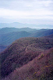
| Wayah Bald (not so bald as we were
led to believe) |
|
2/24 Burningtown Gap campsite - NOC (12.7
miles)
"We choose our joys and sorrows long before we
experience them."
-Kahlil Gibran We each shed clothing
all night, getting up early (and with our car waiting, we're packed
and fed quickly), and hiking by 07:52. It's
a moderately difficult climb up Copper Ridge Bald, although in the
cool of the morning it's not bad, and re-taping of my right heel has
quenched its pain. At Cold Spring shelter, we meet two late
risers in their sleeping bags, both up, but in no hurry to get out.
One is a rasta-looking sort, complete with dreadlocks, and his buddy
brags of their trapping two mice last night. They're going from
Dick's Creek to Clingman's Dome over a couple weeks, although with a
week behind them, it appears they'll come up short. EB is just ahead, looking
for water,
having camped just past the
shelter. The trail is easy, and they pass us descending
to Tellico Gap, where the trail turns back uphill for our last major
climb. We push up to Wesser Bald - topped by an observation
tower, and here we find both EB & Downhill and a couple of
section hikers. EB & Downhill are looking for a ride into Bryson
City from the NOC, and we're happy to oblige.
After sampling the tower's view, we start the
long downhill, showing a steady grade on the profile, but in reality
jumping straight up and over every knob or hill.
We exhaust our water in the process, which drags on and on with the
extra uphills. At the "Jumpup" the descent
begins in earnest, and I barrel down the hill towards the
car, though Coleen lags behind. At the bottom I find EB and Downhill
thumbing a ride, with Coleen emerging from the woods as we start to chat.
As I wave to her, an approaching pickup reads this as a
hitching signal and pulls over (where are these guys when
we're trying to hitch?), leaving me to bid a quick goodbye to
them before they head in. Our car awaits, with a note from Downhill
that they'd be trying to hitch; and we toast our completion with
surprisingly cold Diet Coke. We beat a hasty path to the Sleep
Inn, and by 5:00 we're cleaned up,
with 47 emails downloaded, and off in search of
town food.
We dive into a Mexican feast with reckless
abandon, and Coleen into a huge margarita. We're satisfied, but not
stuffed in spite of its size, and thence head around town looking
for the Scenic View motel where EB and Downhill were staying. We
never find it, and return to our hotel, finding another hiker
looking for a ride back to his car. We offer our help,
setting up an 08:00 am dept, and settle back to our "civilized" mode,
Coleen falling asleep at 10:30, and me at 11:15.
| |


